Historical June 1999 article. Dates, prices, services and contacts describe the source period; current availability has not been established.
As our “neighborhood lands” made this change from virgin country to subdivision, four other developments occurred which served to give our neighborhood its present physical definition.
The first of these occurrences was the gradual “civilization” of the River Des Peres.
It was on the banks of this river that Madame Papin’s land grant was laid out. Almost 100 years before the grant and 65 years before the founding of St. Louis, Jesuits from Quebec set up a mission among the Kaskaskia Indians who were living at the mouth of a little stream flowing into the west bank of the Mississippi just east of the present Alabama Avenue.
This stream came to be known as River Des Peres or River of the Fathers. (6, p. 394).
The head of this stream is about seven miles northwest of Forest Park. (5, p. 112) it meanders southward through Survey 378 draining a total watershed of 70,000 acres.
The branch which enters the city near Delmar Avenue flows through the SkinkerDeBaliviere area to Forest Park and then eastward to Kingshighway. (56, p. 14) Mr. Claude H. Wetmore (grandfather of Mrs. Betty Renard, one of our present neighbors) described this problematical river in his book Out of a Fleur-de-Lis; It is a crooked, treacherous thing, this stream, and has borne that reputation since the time when St. Louisians pushed their homes and farms back from the Mississippi’s banks; and it has no title to the name of river except during a few months in each year, for in the summer it is a sike, the bed so dry as to offer a comfortable walk, dotted with many rocks which make famous resting-places when one is tired.
But let a heavy rain fall and an angry, noisy mass tumbles through St. Louis county and the suburbs of St. Louis city, frothing in its effort to reach the “Father of Waters”; yet the desire satisfied, it refuses to mingle with the main channel and impresses its individuality by an extended yellow streak born of the clay which it has carried along In passage. Drive out any road that takes you beyond the limits and you will meet the River Des Peres in a half-dozen unexpected places, wriggling and squirming like a snake, doubling on itself frequently and at other times seemingly tied in a bow-knot. Let the rain continue a night and a day, and many of the acres of land that had appeared between the vexatious turns are overflowed; a week’s steady downpour and the original crooked river becomes a broad wave, moving over wheat-fields and railroad tracks and reaching out hungrily for the little houses of truck gardeners. (17. p. 124) It was the urbanization of the Skinker-DeBaliviere area which finally led to the concrete encasement of this “individualistic” stream under the street which bears the river’s name.
The first steps to control the river were taken as more and more construction went on in our neighborhood.
In 1914 the City Plan Commission reported that extensive building and street paving in the River Des Peres watershed had caused a greatly increased run-off of storm water during any rainfall “so that the channel of the stream is not sufficient to carry the volume of water away and serious flooding occurs.” (56, p. 15) The storm water problem increased and to it was added a sewage problem.
When the Rosedale-Skinker section was developed, a small sewer was built along the bottom of the river which carried not only the sewage of this section, but that of the whole area drained by the river from the city limits to Union Avenue in Forest Park. “The growth of this part of the city has been so great, however, that the increased flow of sewage generally over-taxes the intercepting sewer so that even a small rainfall or even a street sprinkling causes a considerable amount of sewage to overflow into the river channel.” (56, p. 16) Although the river was a nuisance to most adults because of the flooding and stench, most of the time it was an exciting play area for the neighborhood children.- Judge Daniel B. Tammany, who grew up and still resides in the 6100 block of McPherson Avenue, remembers the river as it was when he was a child.
The river banks were “as wide as a street and about 40 or 50 feet deep.” The water, however, was only “as wide as a table” except during the spring rains.
There were bridges at Waterman, Kingsbury and Delmar for cars and a footbridge at Pershing. Where there were no bridges, wooden barricades ran along the banks.
The barricades didn’t keep the children from climbing up and down the river banks. Judge Tammany and his friends used to dig caves in the side of the banks and roast potatoes there over open fires.
In March of 1930 work to encase Section F of River Des Peres began.
This section includes the portion of the river which runs through our neighborhood. (62) During this construction, part of Voges’ drugstore, located on the northeast corner of Kingsbury and Des Peres Avenues, collapsed as did some corner houses. Other corner houses were purposely demolished to prevent their untimely collapse.
The work was completed in 1931 and the river no longer served to divide the neighborhood. Our “individualistic” river has not been completely “civilized”, however, and still brings problems of leaking and settling to basements on corner lots along Des Peres Avenue and even minor street flooding as recently as 1970.
A second occurrence which helped shape and define our neighborhood was the creation and development of Forest Park. Forest Park has more of a relationship to the neighborhood than just forming its southern boundary.
The World’s Fair held in this park resulted in improved transportation and in publicity for an area of St. Louis which at the turn of the century was mostly vacant land available for development.
The proximity of Forest Park, with its recreational and cultural facilities, made potential homes nearby highly desirable.
This proximity brought the neighborhood rapid development after the World’s Fair. Although Forest Park is now an outstanding recreational and cultural center, its creation was extremely controversial. Hiram W. Leffingwell proposed the creation of this park and led the forces which battled for four years in and out of court to have that proposal approved. One source speaks of Mr. Leffingwell and his “patriotic associates [who] did not stand to profit in any way from the proposed development.” (35, p. 5) Other sources say Leffingwell, a successful real estate promoter, was inspired by the high prices of lots surrounding New York City’s Central Park.
In the late 1860s Leffingwell had gained control of 40 or 50 acres in the west part of the Lindell Tract along the east side of Kingshighway. Kingshighway was then a muddy lane running through a flat swampy meadow alongside the Cabanne dairy farm which included the site of the present Westmoreland and Portland Places.
The idea of selling lots there would seem fantastic to most men, but Leffingwell had an ingenious sales idea.
He would get a park established across from his subdivision and be able to charge high prices for lots surrounding this St. Louis park just as had been done for lots surrounding New York’s Central Park. (6, p. 192) In 1870 Leffingwell had a plan of the proposed park drawn up and obtained the pledge of Nicholas M. Bell, who had just been elected to the state legislature, to introduce the bill authorizing the purchase of land for a park.
This bill provided for setting aside some 2,754 acres by the County Court for purchase by the City of St. Louis. Since the owners of property surrounding the proposed park site would receive a special benefit from the park (an increase in their property value), they would be subject to a special tax.
The bill was enacted on March 25, 1872. Angry citizens immediately protested violently and called for the resignation of Nicholas Bell.
Some opponents claimed the park was meant to be a playground for the rich since it would be so inaccessible by public transportation. Others said the land would be better off put to agricultural or industrial use.
The objection raised against the creation of a special tax district was what caused the act to be declared unconstitutional. Since the park was to be of benefit for the whole county (which included the City of St. Louis at that time), the Missouri Supreme Court ruled it to be unfair to place a tax only on some landowners to support it. Leffingwell did not give up.
He and his park supporters, including Nicholas Bell and Presiding County Court Judge Joseph O’Neil, launched a campaign to educate the public to the benefits of the proposed park.
In 1873 this campaign seemed so successful that another attempt was made to get enabling legislation, but no bill was enacted that year (39, p. 36, 37, 50) The strongest objections to the park were heard in the far southern and northern ports of the city where citizens said they could take little advantage of a park which would be so far away. Leffingwell promised to support a park both in the south and the north in return for the support of citizens in those areas for his Forest Park.
As a result of this, the City now has Carondelet Park in the south and O’Fallon Park in the north. (6, p. 192) Former legislator Nicholas Bell, who was in the commission business, was responsible for convincing the two most powerful landowners in the proposed park area, Thomas Skinker and William Forsythe, that a park would enhance the value of their property.
He related the following incident which occurred on February 14, 1873: I went out to Forsythe’s house to see him about the sale of wool from his angora goats that were grazing on the acreage under consideration for park purposes. Mr. Forsythe invited me to stay for dinner, and I accepted.
While we were at the table I suddenly turned to Forsythe and said: “Mr. Forsythe, we are good friends and I have just showed you a way to make money off your goat wool. Will you listen to me on a park proposition?” Forsythe said he would. So I told him that instead of taking 2,800 acres, we would split the tract, starting from the southeast corner.
In so doing, part of his land would be in the park and part of it outside.
I told him I would agree to go before the County Court and ask that he be allowed $600 an acre for all the land he sold.
I also pointed out that any land he had left would be enhanced in value because of its proximity to the park. “Tell it to me again, Nick, ” Forsythe exclaimed.
I did, and he accepted.
Then he said he would go over and see Tom Skinker, who owned considerable acreage that would go into the park. Forsythe brought pressure to bear on his friend, and before the day was over I had these two fellows signed to a written agreement whereby they abandoned all opposition to the park bill. Inasmuch as they were the chief property owners and had financed the objection, the rest was easy and the Forest Park bill was passed that year. Under it St. Louis acquired 1,369 acres of land for park purposes at a total cost, I believe, of approximately $849,000. (21, p. 232) While this “education and persuasion” campaign was being carried on by Leffingwell and Bell, Joseph O’Neil, Presiding Judge of the County Court, advanced $25,000 of his own funds for an option on much of the proposed park land which was for sale at an unusually reasonable price.
This option held the land until The Forest Park Act authorizing the purchase of the land was finally enacted in 1874. (38) This Act reduced the acreage of the park from 2,754 to 1,374 (in accord with what Bell had promised Forsythe).
It approved the sale of bonds for the purchase of the land and increased taxes on all county residents by one-half mill on a dollar for payment and improvement of the park. Suit was also brought against this act by landowners William D. Griswold, Samuel N. Holliday, Charles P. Chouteau and Julia Chouteau Maffitt, whose property would be purchased for the park.
They challenged the constitutionality of the act on two points: first, that the park was too distant from many parts of the county and therefore was not of benefit to all the citizens; second, that landowners were not offered a fair price for their property. Their suit was unsuccessful, however, and the last obstacle to the creation of the park was removed. (39, p. 53) The County Court was given purchase power and appointed three appraisers, John G. Priest, Charles Green and Theophile Papin, to value the grounds and make the allotments of payment to the owners. Coincidentally, Mr. Theophile Papin was the grandson of Joseph Marie and Marie Louise Papin, original owners of most of the tract of land. Hyde and Conard, in their Encyclopedia of the History of St. Louis, report: Years before the park was ever dreamed of, that portion of the Papin farm now included within its limits was sold for a trifling consideration.
When condemned for city use, It brought nearly $800,000.
The grandfather little thought that the trading town of 5,000 population would grow into a great city of over 600,000 inhabitants; that the very farm and home where his family of children were born and grew up, several miles distant from the trading town, would be taken for a public park; or, that his own grandson would have an official part in the proceedings for Its transfer to the city. (9, p. 1694) From the time of its official opening on June 25, 1876, Forest Park was continually improved and beautified.
In 1890 a series of events began which catapulted the park into world prominence.
In that year the federal government was planning an historical exposition celebrating the 400th anniversary of the discovery of America. Missouri’s Governor, David R. Francis, headed a delegation to Washington, D.C., to persuade the federal government to locate the exposition in St. Louis. Although the delegation was unsuccessful, the idea of a world’s fair with an historical theme later developed into the St. Louis Louisiana Purchase Exposition of 1904, celebrating the acquisition of the Louisiana Territory by the United States. Ex-governor Francis was president of the World’s Fair Company.
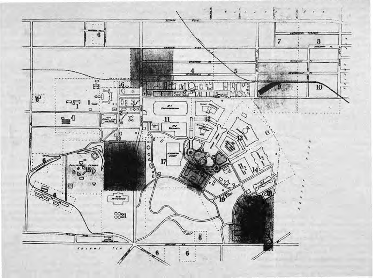
The Fair occupied the western two-thirds of Forest Park (see map below).
It included the territory west of the park to Big Bend and north of the park to the railroad tracks west of DeBaliviere Avenue.
The main entrance was located where the Jefferson Memorial now stands.
As mentioned earlier, the amusement department of the Fair, called “The Pike”, occupied the Catlin Tract (6, p. 334-335) The 1904 World’s Fair left some permanent improvements in Forest Park.
Some of these improvements were the result of preparing the park for the Fair.
The River Des Peres was the biggest problem confronting the engineers of the Fair Company.
It wound every which way through the park and presented a constant threat of flooding.
It was decided to straighten the river as much as possible.
The length of the river through the exposition grounds was cut from 8,800 feet to 4,656 feet.
The new river channel followed the course of the principal streets of the Fair and thus had to be covered.
This construction was entirely of wood.
The entire cost of construction and excavation was $125,000.
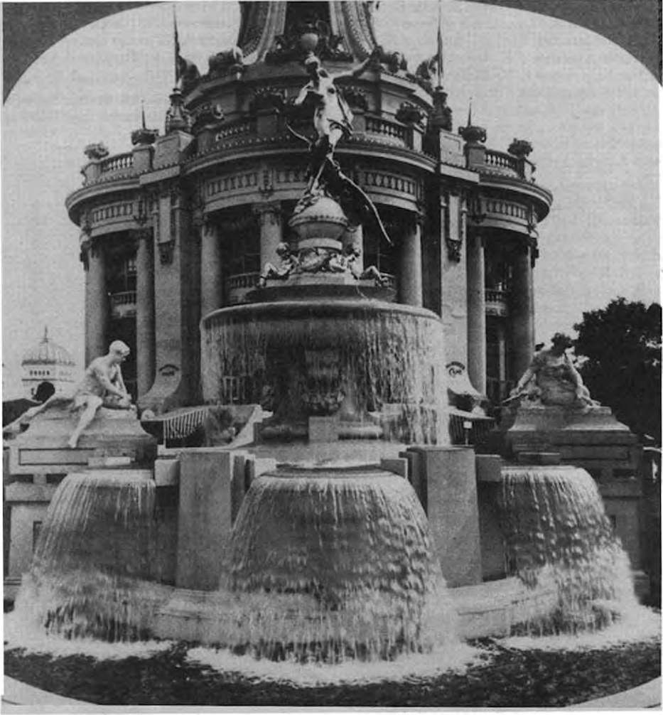
A new sewer system was also constructed. (5, p. 112-116) Outside the Fair grounds, where the river was not covered, two new bridges were built. Besides the improvement of the River Des Peres, paved roads were constructed, a system of lakes along the eastern boundary of the park outside the Fair grounds was developed and the park was made easily accessible by public transportation. (16, p. 235) Other improvements in the park are actual structures left from the Fair. “The Palace of Art” was the only structure of the Fair originally designed to remain after the end of the Fair and for this reason it was the only building constructed of stone.
The center portion of this building is our present Art Museum.
The Bird Cage at the zoo is also left from the Fair. Although the statue of Saint Louis standing before the Art Museum did not exist in 1904, there was a plaster of Paris model of the statue in front of the Palace of Art.
It was from the same mold that the present statue was cast.
In our neighborhood, the building which housed the jai alai courts for the Exposition was left at the corner of Kingsbury and DeBaliviere.
This became the Winter Garden Skating Rink until it was demolished in the Sixties and replaced by a supermarket. Forest Park also benefited from the dismantling of the Fair. Mr. Rolla Wells, Mayor of St. Louis during the Fair, was insistent that Forest Park be restored to its original beauty after the Fair.
On July 29, 1904, the Fair Management Company had to post a bond of $650,000 for this restoration.
After the Fair, the Chicago Wrecking Company was hired to clear away the buildings and debris. George E. Kessler was selected to plan and direct the restoration of the landscape. Under Mr. Kessler’s direction, 75,000 trees and shrubs were planted and 200 acres of meadow grassed. (16, p. 233-235) The work of the wrecking company “was done with great caution. Guards from the army detachment on duty during the Fair remained after the close of the Exposition to prevent theft. Extensive records were made to prevent loss and great care was exercised to avoid fire.
With few exceptions the materials from the buildings were transported to Chicago and sold there.” (19, p. 458) Although we have heard for many years that materials from the Fair were used in the construction of our neighborhood homes, our research seems not to support these stories.
We would like very much to hear from anyone in the neighborhood who could authenticate World’s Fair materials in their home. Ironically, two permanent park buildings were constructed as a result of dismantling the Fair.
The Fair Management Company and the city disagreed about the removal of a small bridge and some drainage pipes.
To compensate for not removing these structures, the Fair Company built the public shelter pavilion located on a hill just east of the main zoo entrance at a cost of $40,000.
The Jefferson Memorial Building was constructed with the money made from selling the salvage from the Fair. (19, p. 466) The third occurrence which is important in shaping our neighborhood is the development of the present campus of Washington University. Washington University had its beginning east of the neighborhood.
On February 22, 1853 the Missouri Legislature incorporated Eliot Seminary named after its chief promoter, Dr. William G. Eliot.
A year later, February 22, 1854, Dr. Eliot was elected president of the institution.
He suggested his name be eliminated from the school. Because both the incorporation and the election of the first president of the school occurred on February 22, the birthday of George Washington, the name was changed to Washington University in 1857.
The first building occupied by the University was a small square building on the northwest corner of 17th and St, Charles Streets. Samuel Cupples had long been interested in the welfare of Washington University. Robert S. Brookings, his partner in the woodenware business, soon shared this interest.
It was because of Mr. Brookings that the University was rebuilt in its present location. At the time of the World’s Fair, the University had not moved into its present buildings so these buildings were rented to the Fair for administrative purposes and to house very valuable exhibits.
In keeping with the theme of the Fair, the Ridgley Library building was patterned after the Cabildo Building in New Orleans where formal transfer of the Louisiana Territory took place.
The University’s field house and playing field were used for the Olympic contests of the Fair and named for ex-governor Francis who was president of the Fair company. (6, p. 250) The fourth development which most immediately defined the Skinker-DeBaliviere Neighborhood was the laying out, construction and naming of our streets.
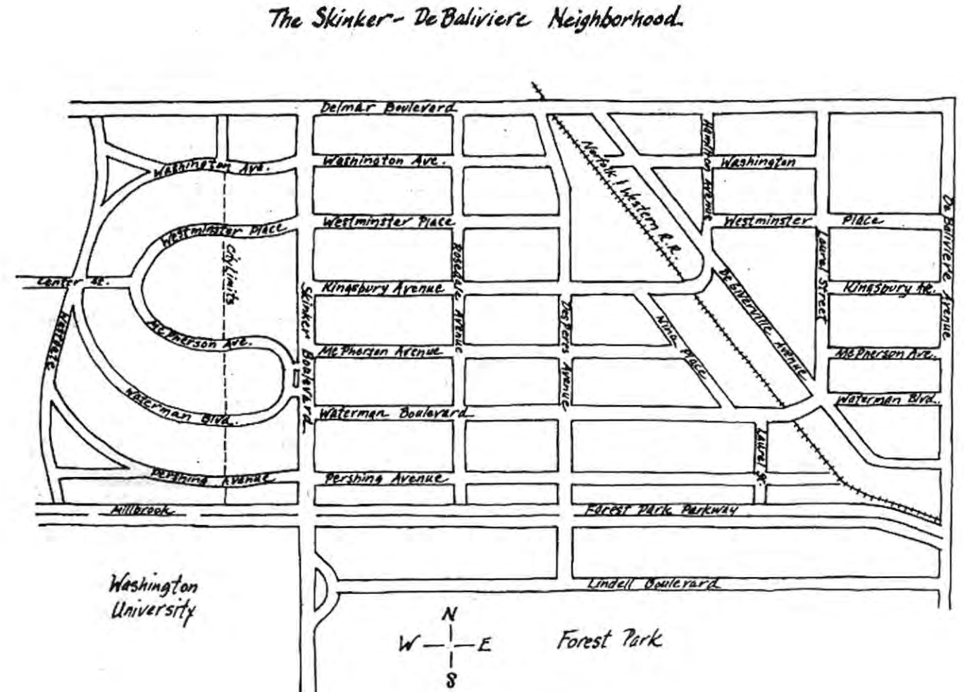
The street names fall into two groups—those that are the continuation of streets already named in developments east and north of the neighborhood and those which are connected with the history of this particular area. Coming to us from the east are such streets as Lindell which is named for a family whose members, Peter and Jesse, were very successful business men and later holders of vast tracts of land in the early and middle 19th century. (6, p. 343) McPherson Avenue also begins east of our neighborhood and similarly is named for a very successful business man, lawyer and real estate man, William M. McPherson.
It was through real estate that he amassed his fortune, but he was involved in such diversified enterprises as organizing the Bellefontaine Cemetery Association, serving as president of Missouri Pacific Railroad, and holding extensive stock in the St. Louis Bridge Company and several banks. (13, p. 229-230) Washington is named for our first President. Delmar gets its name from the history of land east of our neighborhood.
This street followed the boundary line between two tracts of property—one owned by Trusten Polk, the other by John Hogan. Since Polk was from Delaware and Hogan from Maryland, the street name was derived from the combined first three letters of each state name. (36) Westminster was probably named by a man having English family heritage. Laurel is named for the tree and originates in a subdivision using tree names. Hamilton Avenue perpetuates the name of Hamilton R. Gamble, governor of the state.
The Forest Park Parkway takes its name from the park it runs beside and through from Kingshighway to Skinker. (6, p. 344) No explanation of either Rosedale or Nina could be found.
However, we do know that Washington Heights 1st Addition was developed by Nina Realty Company.
Another group of street names comes from the family history of the Kingsburys and appears on the plat showing the division of the Kingsbury Farm in 1873 (see p. 11).
The most obvious of this group is Kingsbury Avenue. Both Kingsbury daughters attended a convent school in Paris whose Mother Superior was Madame DeBaliviere.
The title of Mary Virginia’s husband, Armond Francois Robert, Count DeGiverville, was given to a street originally planned to run westward from Union to Skinker.
When Parkview and Washington Heights subdivisions were developed, the sections of the original DeGiverville from DeBaliviere east to Union and the Wabash Railroad tracks west into Parkview were renamed Berlin.
After this, De Giverville began at DeBaliviere and ran parallel to the railroad tracks curving to end at Delmar Avenue a short distance north. Several years later, in 1918 during World War I, the name Berlin was changed to Pershing. (6, p. 344) This was done both to honor Missouri’s General John J. “Black Jack” Pershing and to remove the German name (a common patriotic practice—sauerkraut was renamed “victory cabbage”). Adele Kingsbury’s husband gave his name to two streets—the present Waterman Avenue bears his last name.
The present Belt Avenue originally bore his first name—Alfred.
Another street named for the Kingsbury girls’ grandfather, Jacob Kingsbury, was shown on the plat of 1873, but evidently never developed. (see p. 11) One street in our neighborhood was the center of controversy around the time of the World’s FairSkinker Road. Many people felt that Skinker Road was not an appropriate name for a thoroughfare of such wide prominence. Mr. Gibson, a St. Louis councilman, introduced a bill to change the name from Skinker Road to Rochambeau Avenue.
This name was in honor of the French count who aided American independence and took into account the fact that the French exhibit at the Fair would be located on this road. (60, p. 123) The name was not changed.
In fact, a poetry contest was held by The St. Louis Republic to inspire local pride in the name Skinker Road. Walter B. Stevens, Secretary of the World’s Fair Company, was quoted in The Republic of September 14, 1902 as saying: “The idea of awakening local pride in giving to the ‘Midway’ of the Exposition the stickative title of Skinker Rood is thoroughly American in sentiment and the proposed (poetry) contest is a fine medium of arousing popular interest in the perpetuation of a highway filled with the city’s earliest savor. ” (60, p. 124) The contest was won by a Kentuckian, Mr. Henry Cleveland Wood, and is discussed by characters in Mr. Wetmore’s book: “Skinker! What a prosaic name,” exclaimed Mrs. LeGrande. “Yet they have written poetry about it, said her sister.
It must have been a very difficult task. ” “Poets can do anything. Marietta, do you remember the verses that were Judged the best in the prize contest?” “Yes, mother.
The poem is named ‘Polly,'” and she recited:— “Oh! Polly do you mind the day When Dobbin bore a double load, And you and 1 were on the way To Singin up the Skinker Road? “Your bonnet caught a brier spray That pulled it and your hair awry; I freed you in my awkward way, And—then! don’t blush; I won’t tell why. “Ah! that was many a year ago. How time does fly when hearts beat true; Your cheeks were red as roses blow. Your eyes like diamonds made of dew. “How scenes have changed and faces passed, Fond hearts grown still that with love beat; Our own heads crowned with snow at last, Life’s path now trod with halting feet. “Yet once again the winding ways We travel to the Great World’s Fair. What! this the spot of other days? And blushing, sweetheart, I declare. ” (17, p. 115-116) Subdividing For Residential Living.
The history of our neighborhood land until it became the Kingsbury Farm, the subsequent division of the Farm between the two Kingsbury girls, and the influence of the River Des Peres, Forest Park and Washington University upon our portion of the city are extremely important as we begin to trace the actual development plans and construction. No doubt many men over the years had examined and appraised the land on which the neighborhood sits, considering how best to develop it. Bell Place (Washington Terrace and Kingsbury Place) had begun in 1894.
The Cabanne District north of Delmar had long been under development as a fine residential area. Forest Park was officially opened in 1876 (the same year that the city and county had separated).
The road to Thomas Skinker’s home (near what is now Ellenwood Avenue just beyond the city limits in Clayton) had been traveled at least every Sunday, when Skinker held a sort of “Open House” for his friends all day.(18, p. 156) Surveyors must have been on our land over and over again. Why was it still undeveloped territory at the turn of the century?
As can be seen from the map explaining the division of the Kingsbury Farm (see p. 11), the River Des Peres snakes back and forth through the area.
The quotation earlier in this history (see p. 14), concerning the river overflowing the land between its turns after a hard rain, explains why our area was not already developed.
The river would have to be controlled before development began, and that would have meant a large investment. Taking all of this into consideration, it is not surprising to find that when development actually began, this entire area was under the control of a single company. That company was the Parkview Realty and improvement Company, an association of men apparently investing large sums of money.
We have no way of knowing who was included or how much money was involved from each man. That Parkview Realty did intend to treat what is now the entire Skinker-DeBaliviere Neighborhood as a single entity is spelled out later, as will be seen in the discussion of their 1903 Prospectus.
For this reason, we have focused our research on The Parkview Realty and Improvement Company and attempted to follow its various transactions over the years of primary development.
Each portion of the Parkview Realty story has had some impact on making our neighborhood what it is today .
On November 12, 1901, Henry S. Caulfield, attorney for the Lincoln Trust Company of St. Louis, forwarded to the Missouri Secretary of State the certified articles of incorporation for “The Parkview Realty and Improvement Company” plus Lincoln Trust’s check to cover incorporation tax and the state’s fee.
The incorporation papers were filed and recorded November 13, 1901. Parkview Realty’s capital stock was $5,500,000, a huge sum for that time.
This was to be divided into 55,000 shares of $100 each.(48) The stock and the company directorships were oddly divided among the six original incorporators.
The major identifiable stockholder was Adrian Ogle Rule, vice president of Kilgen-Rule Real Estate Company.(3, p. 515) Of the 55,000 shares, 5,000 were preferred and 50,000 common. Rule held all 5,000 preferred shares plus 4,170 shares of common stock, apparently a personal investment of $917,000. Rule was also one of the five directors named in the articles of incorporation.
The other four directors were: Thomas Wright, a former cigar manufacturer who was engaged in real estate, investments and banking at the time;(3, p. 652) George F. Durant, General Manager of Bell Telephone Company of Missouri and first vice president of the Lincoln Trust Company;(2, p. 169) Edward H. Coffin, St. Louis passenger and ticket agent for the Wabash Railroad;(3, p. 125) and Moses Greenwood, Jr., a former U. S. Assistant Civil Engineer associated with his father in a general real estate business.(2, p 238) These last four owned one share of common stock (at $100) each, and were named directors. Courtland B. Van Sickler was not named a director and subscribed for 45,826 shares of common stock ($4,582,600).
He was listed in Gould’s 1903 Directory of the City of St. Louis as a clerk at the Carleton Dry Goods Company. (8) Van Sickler had a lot of money at his disposal in 1901.
He not only made this enormous investment but also bought some interesting parcels of land, cited previously (see p. 13). Perhaps someday it will be discovered just who (singular or plural) Van Sickler was.
It could be quite interesting’.
On February 10, 1902, a meeting of the stockholders of the Parkview Realty and Improvement Co. voted to change the number of directors from five to seven; names of new (and/ or different) directors at this time are unknown. (48) Despite the fact that Parkview Realty’s incorporation papers state that “the same (amount of capital stock – $5,500,000I has been bonafide subscribed and all thereof actually paid up in lawful money of the United States, which is in the custody of the persons hereinafter named, as the first Board of Directors,” (48) less than a year after incorporation, in 1901, and the addition of two more presumably wealthy persons to its Board of Directors, Parkview Realty was apparently in money trouble.
The company had debts of $3,500,000 on the land it owned: the Catlin Tract, the present Parkview Subdivision, and the land from Skinker to DeBaliviere, Delmar to the present Forest Park Parkway, excepting the northeast corner (Laurel to DeBaliviere. Delmar to the alley north of McPherson) The World’s Fair site had been officially selected on June 28, 1901,(5, p. 46) and Parkview Realty’s large parcel of land on the Fair’s northern boundary could conceivably be leased to hotels, restaurants, and exhibitors who wanted to be nearby, or even as campgrounds for Fair-goers (as actually happened in University City). Whether there was real financial difficulty within Parkview Realty or not, we don’t know, but the possibilities should be presented. Their property, excepting the Catlin Tract, had been purchased from eighteen different owners by this new, seemingly innocuous developer.
On July 1, 1902, Parkview Realty took out a first mortgage on all their land for $3,500,000 in order to consolidate and pay off their debts.
This mortgage was held by Lincoln Trust Company, who was to issue 5,000 5% gold bonds as the need arose.(32) With a lack of hard facts, questions easily arise. Was it easier to buy the land as a simple real estate development company and was Lincoln Trust, through its officers, behind this whole deal from the beginning? Remember, George F. Durant was Lincoln’s first vice president. Or was his interest purely personal, and when financial difficulties arose, his contact with Lincoln Trust merely a godsend to bail them out? How about Lincoln Trust’s president, A.A.B. Woerheide, who became prominent in development of the Parkview Subdivision? Was his later involvement merely to protect Lincoln Trust’s investment in this mortgage? Consider Edward H. Coffin, an original Parkview Realty director, who was associated with the Wabash Railroad which ran through this area. Was he merely understandably bright in seeing the possibilities of the land through which the railroad passed or did he represent speculative railroad interests?
Then there is Thomas Wright.
He was the president of Parkview Realty and a real estate and investments man himself. Or perhaps the key lies with the only identifiable large investor, Parkview Realty’s secretary, real estate man Adrian 0. Rule. Were the plans for the World’s Fair the whole reason for Parkview Realty’s existence? Perhaps this whole deal was open, aboveboard and purely business speculation, the presence of Courtland B. Van Sickler and his huge pile of money merely obscuring sound business practices from our view some 70 years later. Whatever the case, we hope that this illustrates the need for maintaining an ongoing neighborhood history, to limit the speculations caused by lack of information. Probably sometime during 1903, another phase of Parkview Realty and Improvement Company’s history began to unfold.
The company issued a “Prospectus”, not printed as were so many documents meant for public eyes, but typed with carbon copies or “dittoed” which probably meant a very limited distribution.
This prospectus proposed formation of a new real estate company to buy and develop what is now the Parkview Subdivision, emphasizing the investment possibilities in a scheme which indicated a return of 370% on investment In three years. (53) The map accompanying the Prospectus clearly showed the “Grounds of the Louisiana Purchase World’s Fair” colored red, with placement of the larger buildings blocked in.
This appears to be Parkview Realty’s own map to indicate the location of its properties within the metropolitan area. Hand-shaded in blue, the area of development by the proposed new company is clearly visible.
The prospectus states Parkview Realty’s intentions of “improving the immense tract” they owned “as one property, which plan would so develop that the building and treatment of each part will add to the value and betterment of the remainder. “(53) By the time the Prospectus was issued, the Catlin Tract from Union to Skinker had already been “graded and improved with streets, gutters, curbs, sidewalks, sewers, gas, trees and shrubs, all at an expense of about $350,000″(53) The rest of Parkview Realty’s property, from DeBaliviere to Melville, and Delmar to the railroad right-of-way, had just been graded at a cost of about $500,000.
To quote from the Prospectus: This newly graded portion has peculiar value because of the following reasons: 1.
It is directly in the line of channel of the best residential property in the City, and is the last and only property of its kind that remains; 2. Its surroundings are all that can be desired – Westmoreland, Portland and Bell Places on the East, – the Cabanne District on the North – and Forest Park and the Washington University, with its magnificent endowment on the south insure for this property for all time to come, desirable features and an exclusiveness with social surroundings which are most essential factors in the problem of permanent values. 3.
The transportation facilities are perfect as a double street car loop has been provided, – with a double track West on Delmar to Skinker Road and East on DeGiverville [now Pershing] and McPherson Avenues, to accommodate all Olive Street cars, which will divide at Taylor, one-half going North and West on Delmar to Skinker Road, and return East on DeGiverville and McPherson Avenues, the other one-half going West on McPherson and DeGiverville to Skinker Road, and returning East on Delmar Avenue to Taylor and Olive. 4.
The City Water is in Skinker Road, and the grading has been completed and the most desirable of all grades established, viz., an Eastern Slope, i.e., the grade beginning at DeBaliviere Avenue rises gradually and uniformly to the Western Limits of the property at Melville Avenue, which is 40 feet above DeBaliviere on Kingsbury Boulevard, the centre of this property.(53) Parkview Realty’s plans for all of its property, as listed in this seemingly private Prospectus, are what have led us to surmise that there might have been prior knowledge of the site of the Fair, before it became officially selected.
They state: The Parkview Company divides its property into three tracts and proposes to treat them as follows: First: The Catlin Tract – to lease to World’s Fair, Railroads and Hotels. Second: That portion between DeBaliviere Avenue and Skinker Road-temporarily to lease to Hotels, Restaurants, Cottages, &c., for World’s Fair purposes, and after the Fair to be devoted to high-class Apartment Houses and Residences . Third: That portion West of Skinker Road to be sold to a Company at a nominal price in order to secure immediate improvement of streets, buildings, &c., which will be undertaken at once, and thus enhance and add to the value of the remainder of the property which will be handsomely improved when the contemplated temporary structures shall have been removed.(53) It is the third tract of land with which this Prospectus deals, and for acquisition and development of which the proposed new company is to be formed: It is the purpose of those who form the new Company to purchase this tract of ground and to thoroughly improve the same with streets, sewers, sidewalks, curbs, water, &c., and to arrange for the building of flats or apartments on portions of the propDr. Augustus Charles Bernays erty, reserving the remainder for artistic homes, in this artistic tract in the midst of these artistic surroundings. (53) In the “Financial Scheme” section of the Prospectus is the heart of the proposal: organize a company under Missouri laws with a capital stock of $200,000; $50,000 as first payment on the property, $150,000 to have the improvements made at $7.50 per front foot. Presumably Parkview Realty would do this with the cash from the capital stock subscription. Parkview Realty estimated conservatively that the value of the improved lots, ‘without adding anything for World’s Fair values. . . would be from $75.00 to $100.00 per front foot” and “. . . agreed to sell this property to a syndicate of friends and insiders at practical cost to the Company, viz., $32.50 per foot or $650,000.” The company wanted $50,000 in cash and a deed of trust for $600,000 at 5% for three years. “. . . the terms are such as to enable the subscribers to realize the maximum of returns for the minimum of investment, for if the property is bought, improved and sold within three years at an average price of $75.00 per front foot, the return to each subscriber of $5,000 would be $18,500 . .” says the Prospectus.(53) There is no doubt that the offer made by the Prospectus was considered a good one indeed.
On January 11, 1904 Articles of Association were signed forming just such a company as the Prospectus had proposed: to buy for $650,000 the land of Parkview Realty west of Skinker, lay it out, improve it, sell it, form a corporation and accumulate a cash fund of “not less than $200,000 nor more than $300,000.” Lincoln Trust Company of St. Louis was to be agent and trustee, to hold the money, and to get the company incorporated.
The signatures of 24 prominent St. Louis business and professional men, with their pledges of $5,000 each, appear on this document.
The Kilgen-Rule Realty Company pledged $16,000 under the signature of its president, Rudolph F. Kilgen. Architect William Albert Swasey made a trustee’s pledge of $50,000. Adrian 0. Rule, leading identifiable stockholder in Parkview Realty and Improvement Co., pledged $5,000 and was one of the original trustees.(29) Presumably his initial investment in the property was taken into account in waiving the rest of the trustee investment.
Another original Parkview trustee was Henry S. Caulfield, whose signature and pledge do not appear on this original document but among whose papers the document was found.
If Caulfield had indeed also pledged $50,000 as a trustee, the total cash fund of the company would have totaled $236,000, enough to have the improvements made and a little extra capital.
The signers of these Articles of Association were obviously the “friends and insiders” the Prospectus intended to sell to: Thomas Wright, an original director of Parkview Realty; A.A.B. Woerheide, president of Lincoln Trust Company at the time of Parkview Realty’s incorporation; George W. Lubke, Lincoln Trust’s second vice president; J. H. August Meyer, their third vice president, and presumably Henry S. Caulfield, Lincoln Trust’s attorney at that time. Other signatures include: Julius Pitzman—brilliant longtime City Surveyor and planner of “private places” (Benton, Vandeventer, Westmoreland and Portland, as well as Compton Heights, Flora Boulevard, and Parkview Subdivision), the introducer of “the system of selling property under restrictions” and “chief engineer of Forest Park until plan was completed and drives laid out” . (3) Henry Nicolaus—rich brewer who Lincoln Steffens reports in his 1904 book The Shame of the Cities, was tried for bribery during the reform era in St. Louis and who quickly received a directed verdict of not guilty when he pleaded ignorance of where his money had gone. Murray Carleton – president of Carleton Dry Goods Co., where the mysterious Courtland B. Van Sickler worked as a clerk. Bernard Griesedleck – secretary of the National Brewing Company. L. R. Blackmer – president of Blackmer & Post Pipe Co., manufacturers of sewer pipes and kindred products. C. Marquard Forster – vice president of the St. Louis Brewing Association and manager of the City Brewery Branch thereof. Charles M. Skinner – president of Buxton and Skinner Stationery Company. John C. Roberts – vice president of Roberts, Johnson and Rand Shoe Company (later International Shoe Company). Antoine B. du Pont – second vice president of the St. Louis Transit Company. Ferdinand Herold – president of the Cherokee Packet Company and owner of a zinc mine at Webb City, Missouri. Charles R. Blake – president of Sligo Iron Store Company, iron merchants. George E. W. Luehrmann – president and treasurer of Charles F. Luehrmann Hardwood Lumber Company. Moses H. Alexander – funeral director, who later listed himself as a director of Beredith Realty Company. Fred Schafer – unidentified, perhaps in the insurance business.
Dr. Augustus C. Bernays – internationally known surgeon, professor of anatomy and surgery at medical colleges of St. Louis. Lizzie Blumeyer – mother of George Blumeyer, president of the Eagle Supply Company. Sylvester P. Keyes – president of Keyes-Marshall Bros. Livery Company, with seven locations, one at the Planters Hotel. Henry J. Stone – treasurer, J. S. Merrell Drug Company, wholesale drugs. Gustave W. Niemann – president of the Title Guaranty and Trust Company.(2,3,8,9) Preparing the way for the appearance of another (as we speculate) Courtland B. Van Sickler type, these real Articles of Association say outright that the persons signing may have a “straw party” stockholder in the future corporation who will immediately transfer his stock and interests in that corporation to the person who has actually put in the money.
These “straw parties” may or may not even have a legitimate interest in the corporation themselves. Parkview Realty, meanwhile, was looking to the World’s Fair to realize some profits, as the Prospectus has shown.
When the western half of Forest Park was selected as the Fair’s site in June, 1901, the architects commissioned to design the Fair decided that this 657 acres “would not afford sufficient space for the plans in contemplation. Negotiations were opened looking to the annexation of additional territory for exposition purposes.” (5, p. 46) Accordingly, the Catlin Tract from DeBaliviere to Skinker (59.6 acres) was leased and become the “Pike” area, and another 1.5 acres of Parkview Realty’s land was added.
This resulted in payments totaling $208,500 by the Louisiana Purchase Exposition Company to Parkview Realty.
The great plans for leasing land “to Hotels, Restaurants, Cottages, &tc., for World’s Fair purposes” mentioned in the Prospectus apparently never materialized. Aborted plans for a midway off the grounds of the Fair, which were thwarted by the Fair’s leasing of the Catlin Tract for “The Pike”,(5, p. 92) could well have been part of Parkview Realty’s plans, not fully stated in the Prospectus.
The official book of maps of the World’s Fair shows only a frame hotel (“The Germania”) at the northeast corner of Skinker and Forest Park Parkway. No other buildings (temporary or permanent) existed within all of Parkview Realty’s land with the exception of the Catlin Tract’s “Pike”. Several large hotels, however, were constructed on the east side of DeBaliviere.
If the off-grounds midway idea was indeed Parkview Realty’s, it would account for the curious specification in the Deed of Trust between Parkview Realty and Lincoln Trust in 1902 that leases could be made but that “no lease shall be made . . . for a term continuing longer than July 1, 1907”,(32) although the bonds to be issued under the Deed of Trust were not payable until July 1, 1912.
This could be construed to insure that the Fair people were paid up and gone before the bonds came due. By 1905, the Fair over and in the process of being dismantled, actual development of our neighborhood began.
The Parkview Subdivision plat was filed and recorded at the Office of the St. Louis Recorder of Deeds(59, Book 17, pp.42-43) on November 21, 1905 by Beredith Realty Company, A.A.B. Woerheide, president, J. H. August Meyer, assistant secretary.
On August 8, 1904, Beredith Realty had hired St. Louis architect William Albert Swasey (one of the signers of the Articles of Association, presumably as a trustee) to do the architectural work and supervision on at least 20 houses in the Parkview Subdivision for a period of three years.(31) Julius Pitzman himself had designed this subdivision and drawn upon the experience gained from problems developing within his earlier designs.
There are no straightthrough streets, no long vistas of houses sitting in rows.
All streets are curved and, where there could have been a typical subdivision view of houses upon houses in all directions, small triangular parks with trees offer instead a sense of privacy from all but immediate neighbors (50) The Parkview Subdivision was also set up as a trusteeship, with Adrian 0. Rule, John C. Roberts, and Henry S. Caulfield as the first trustees.(58, Book 1910, p. 1) The trustees in effect controlled the land.
A comprehensive list of restrictions on the property of the subdivision existed, seeking to preserve its character as a fine dignified residential area within reasonable reach of the business, educational and cultural core of the metropolitan area. Buyers were expected to understand and agree to the restrictions.
This trusteeship worked quite well for many years, until progress and inflation made some of its provisions unworkable. Governor Caulfield himself, as the last of the original trustees, assisted in planning for the change in control which would be necessitated by his death.
The change from trusteeship to agency control of the subdivision occurred in June, 1966.(47) Even before Parkview Subdivision’s plat had been filed, Beredith Realty had signed a gas easement agreement with Laclede Gas Light Company on August 1, 1905.(30) Beredith, presumably the corporation set up by the Articles of Association, was ready to go.
But their architect, Swasey, had moved to New York City and a letter from Beredith to Swasey, dated September 22, 1906, shows that problems had arisen. Accordingly, in this letter the contract with Swasey was dissolved by mutual agreement and an ongoing dispute over payment for work already completed was settled thus: having already been paid $4,000, Swasey would pay back $1,500 and give all studies, sketches and specifications already made to Beredith for their exclusive use.
In return, Beredith would convey to Irene McN. Swasey a choice lot in the Parkview Subdivision .(31) This long distance disagreement is the probable reason that no one was actually listed as living in the Parkview Subdivision until 1908. (7) Returning to our embattled friends at the Parkview Realty and Improvement Co., we find them receiving an offer for the whole of what was left of their original holdings (Delmar to Forest Park Parkway, Skinker to DeBaliviere, excepting a small portion at the northeast corner) in November, 1905.
A new group called West End Realty Company offered a purchase price of $1,785,000.(70) On January 9, 1907, West End Realty filed and recorded a plat for the Washington Heights Subdivision (that area we now call RosedaleSkinker), bounded by Delmar and Forest Park Parkway, Skinker and Des Peres Avenue (the last projected as a private street).(59, Book 17, #2, pp.118-119) Acknowledgements.
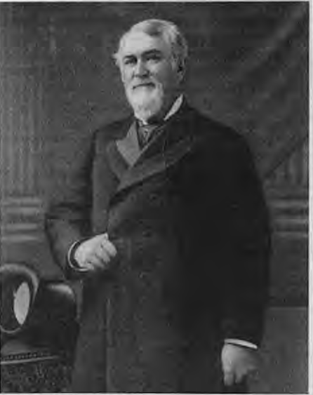
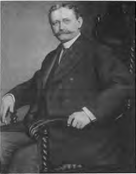
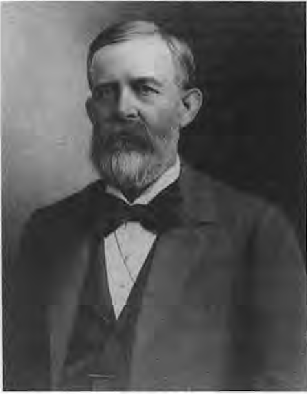
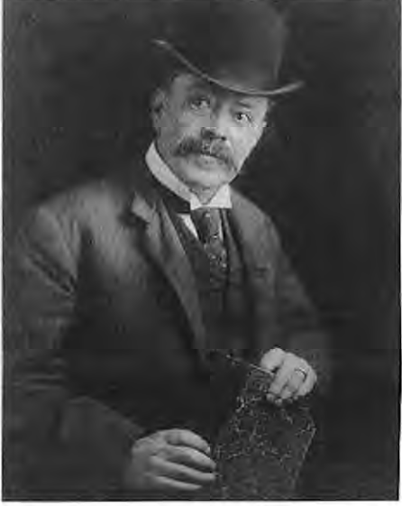
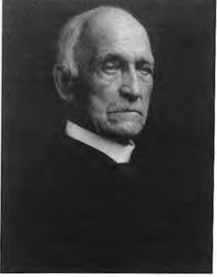
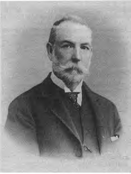
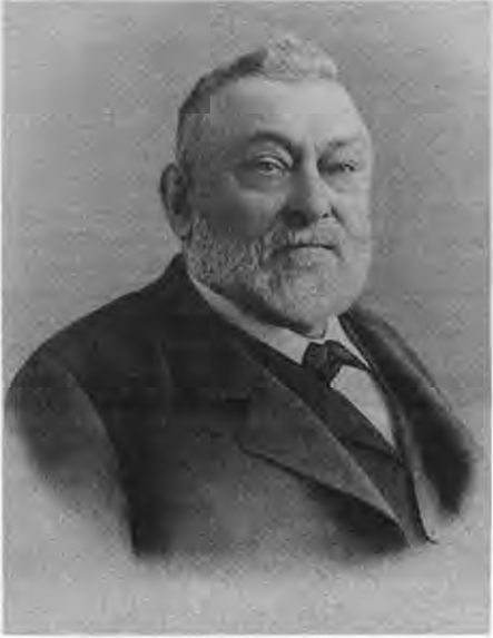
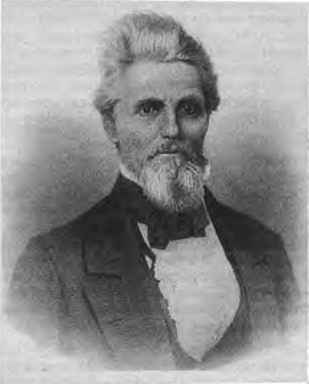
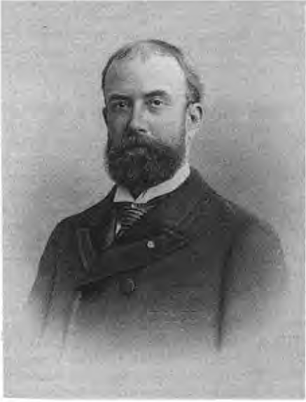
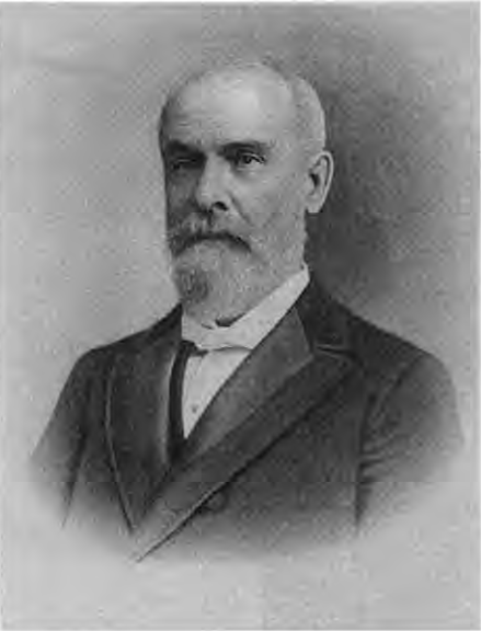
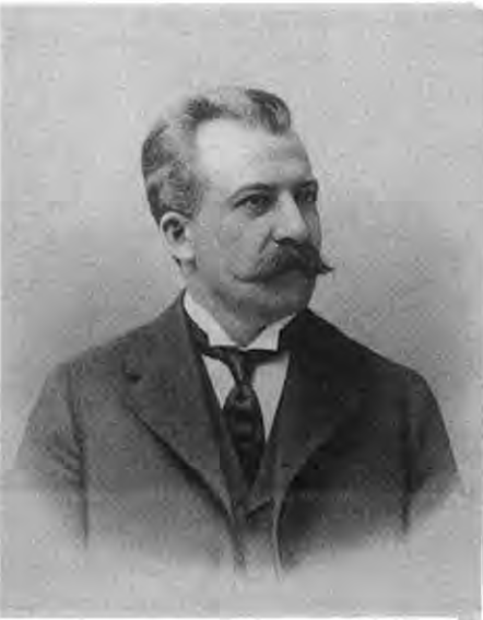
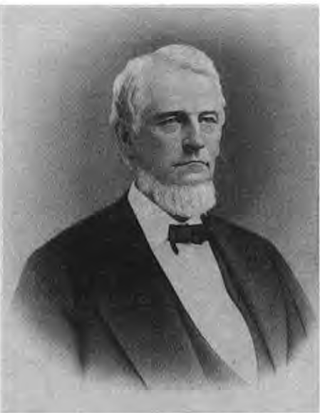
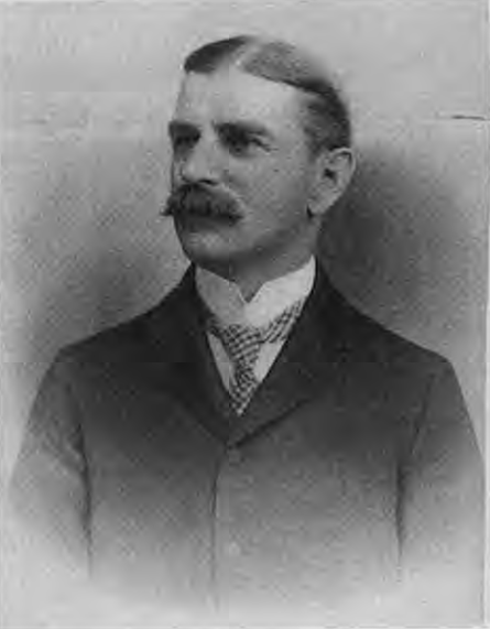
The portraits of those involved in the early development of our area we obtained from the St. Louis Public Library.
The books and photo collection from which they were copied are Reavis, L.U. Saint Louis: The Future Great City of the World. St. Louis: Gray, Baker, 1875. Hyde, William. Encyclopedia of the History of St. Louis. Southern History Company, 1899. Strauss, J.C. Portraits of St. Louisans.
The Times expresses its sincere appreciation for the assistance provided to us in obtaining these portraits to Jean Gosebrink of the Library’s Special Collections department.
We again want to acknowledge the assistance of the Missouri Historical Society’s Karen Goering.
Original photograph caption
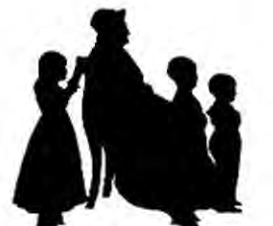
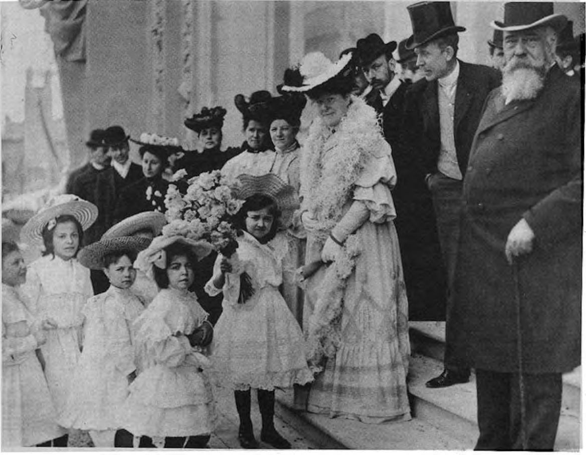
Mrs. Jean Pierre Cabanne (Julie Gratiot) and grandchildren Mary Virginia Kingsbury, Adele Louise Kingsbury and Jules Cabanne Kingsbury. Source illustration; original artist not credited.
Originally published in The Times of Skinker-DeBaliviere, June 1999.
Read this article in the original newspaper issue.
Archival transcription note: Source says less than a year after November 1901 incorporation, in 1901; original chronology retained.; Some original internal page references belong to the 1973 booklet, not 1999 newspaper pagination; source references preserved.
Original source: SD_Times1999_06.pdf, printed page(s) 5, 6, 7, 8, 9, 10, 11, 12; PDF page(s) 5, 6, 7, 8, 9, 10, 11, 12.
