
Historical February–March 2014 article. Dates, prices, services and contacts describe the source period; current availability has not been established.
A long time ago (1983) a study of the buildings in our neighborhood was undertaken by the Landmarks Association of St. Louis.
The study resulted in a map showing each building with the year it was built and a code for the name of the architect or builder. For many years this map resided at the Skinker DeBaliviere Community Council office.
It suffered over that time and until now existed at the SDCC only as a Xerox copy somewhat blurred and smudged because of recopying.
After our meeting in November on House Histories we found that people found it interesting, so we decided to try to improve the quality of the print and also to make it available online. Landmarks retained a much better copy of the map (although someone borrowed the original and failed to return it) and generously allowed us to borrow it for a few days.
We had it scanned and copied again.
We have provided access to the scanned version on our Centennial website.
We broke it down into manageable sections to make it easier to use and to allow easier printing.
To get to this map and its parts, first log onto http://Centennial. citywestend.org/index.html.
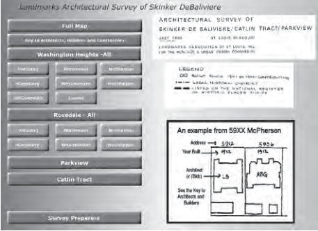
From the Centennial home page select the maroon button that looks like this: This will than display this page The rest should be self-explanatory, but if you have questions or problems, you can contact Marj Weir at 863-7558. Enjoy!
Original photograph caption
Historical website button for Landmarks architectural survey, 1983 revised 1986.
Originally published in The Times of Skinker-DeBaliviere, February–March 2014.
Read this article in the original newspaper issue.
Original source: SD_Times2014_02.pdf, printed page(s) 6; PDF page(s) 6.