Historical September–October 1998 article. Dates, prices, services and contacts describe the source period; current availability has not been established.
The information below is taken from the Cross-county MetroLink Update published and disseminated by the BiState Development Agency. Reprinted is Section 1: Forest Park Station through University City.
The options under consideration run within or along Forest Park Parkwvay and Millbrook Boulevard.
The extension will connect to the existing MetroLink line at or near the Forest Park Station, so changes to the existing station will be required to make a below-grade connection.
Each option would run within or alongside the existing roadways. Issues associated with the location of stations and parking, and the effects of various design options on the neighborhoods along this section will be central considerations throughout the study. Design options are described below. A. Surface Tracks.
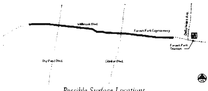
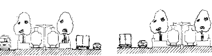
In each of these options, the tracks would slope up from under DeBaliviere, where the line diverges from an expanded Forest Park MetroLink Station. Two options for running lines on the surface are under conPossible Surface Locations sideration. Tracks could run in the median trom just west of DeBaliviere to the point at which Pershing Avenue diverges from Millbrook Boulevard, or they could run on a strip of land along the south side of Forest Park Parkway and Millbrook from just west of DeBaliviere to Big Bend, with the tracks crossing to the north side of Millbrook west of Big Bend.
If it is determined that-rail operations or traffic flow might be disrupted because of insufficient intersection capacity, the design of through lane underpasses could be considered for both Skinker and Big Bend Boulevards.
From Pershing west, lines would run below-grade to the east edge of the Clayton central business district (CBI)) under the Forest Park Parkway pavement. B. Below-Grade Tracks—Cut and Cover Tunnel.
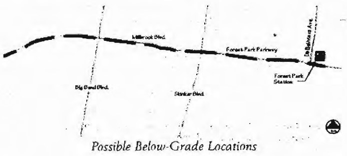
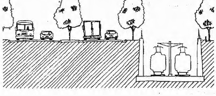
A similar pair of options can be located below.grade. Clearance of the River Des Peres stormwater tunnel will be an important consideration. Two cut and cover options are under study. Under the first option, the line could run under the existing roadway pavement from DeBaliviere to Pershing. Under the second option, cut and cover tunnels would carry tracks underground along the edge of the surface road following the same alignment proposed for the surface lines. C. Below-Grade Tracks—Open Cut.
The alignments for open cut are similar to the cut and cover options, but open to the sky.
The cuts could be bridged at intervals to permit vehicles or pedestrians to cross. Possible Below-Grade Locations
Original photograph caption
Possible surface locations — original Cross-County MetroLink planning diagram. Source: Bi-State Development Agency.
Originally published in The Times of Skinker-DeBaliviere, September–October 1998.
Read this article in the original newspaper issue.
Original source: SD_Times1998_09.pdf, printed page(s) 5; PDF page(s) 5.
