Historical November–December 2013 article. Dates, prices, services and contacts describe the source period; current availability has not been established.
In the 20 years that Metrolink has been running, little direct TOD development has occurred near the Delmar and Forest Park stations. Forces greater than the Metrolink, at play for much longer than the last two decades, have stymied the development potential near it.
A fine book about St. Louis, Mapping Decline: St. Louis and the Fate of the American City gives a melancholy account of St. Louis’ 20th century slide. See the website http://mappingdecline.lib. uiowa.edu/. Finally the tide is turning.
There is greater recognition that silverbullet projects, building more and more highway lane-miles, throwing away old neighborhoods, and spreading our jobs and housing out thinner and thinner isn’t working well.
We simply have to encourage development that is more financially productive in order to have any hope of maintaining the infrastructure and funding the government services we expect (for more on that see strongtowns. org).
Also technological advances, environmental concerns, and an economic boom hangover are changing housing, lifestyle, and transportation preferences.
The dedication to fostering the strong neighborhood in the study area puts it in a position to capitalize on these shifts. For the first time in a long time the developments envisioned in the TOD plan are realistic.
The plan outlines streetscape improvements to varying degrees depending on the street.
These are important to make the street more attractive to pedestrians and add to the sense of place.
We see the difference in pedestrian experience and how it compliments development already by comparing the parts of Delmar that have had a street diet and the parts that haven’t.
The plan calls for extending the diet east to Goodfellow. Pedestrian lighting, marquee lighting, curb cuts, fixing sidewalks, burying/ moving overhead utilities, are all good incremental improvements. Broken, weedy, and littered sidewalks and poor lighting don’t foster a safe feeling. Street trees are encouraged too.
They add shade, beauty, and value; please contact the city to get a free tree if your property doesn’t already have one.
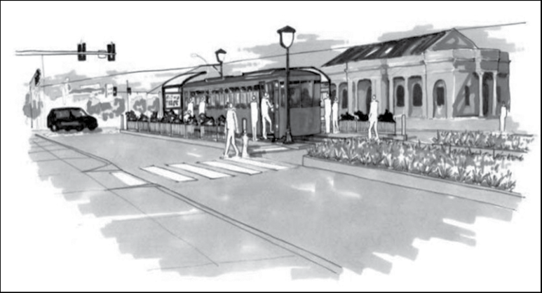
The trolley and greenway will bring some of these improvements.
A great conundrum for the consultants and meeting attendees is what to do with Lucier Park.
The three-acre park was established in 1980 after apartment buildings were torn down and streets vacated. One can see the ghosts of the buildings on Google Maps. Its main problem is that the surrounding buildings don’t face the park. Parks are supposed to add value and draw people out. Lucier misses the mark.
The consultants offer two visions.
Each would take land away from it and add buildings facing it.
I prefer option two because it allows the completion of the street grid, leaves more room for development, puts eyes on it almost all the way around, appears to be more allseasonal, and looks to require less maintenance. Either option would require a city-wide vote since they take land away from the park.
While the TOD planning process is complete, there is one more public workshop for the Skinker DeBaliviere Urban Design Planning Process on Nov 19 6-8pm at the Des Peres School.
These plans will help guide our neighborhood development over the next decades.
The vision of the future is bright; let’s make it reality.
Original photograph caption
Conceptual transit-oriented streetscape illustration; not as-built condition.
Originally published in The Times of Skinker-DeBaliviere, November–December 2013.
Read this article in the original newspaper issue.
Original source: SD_Times2013_11.pdf, printed page(s) 4; PDF page(s) 4.